After a variable spring that saw a range of conditions across B.C., the warmest months of the year are now approaching. As we enter this period of elevated wildfire risk, we are closely monitoring conditions to ensure we’re ready to respond.
To forecast the core wildfire season, we consider three key factors: drought levels, overwinter snowpack and periods of prolonged heat without rain in June. Watch the video to hear more on what we predict for summer 2026 from the Superintendent of the Predictive Services Unit, Neal McLoughlin.
Highlights of the summer 2026 outlook include:
- Long-range guidance favours a warmer-than-normal summer across much of B.C. and Canada
- Long-term precipitation deficits have created above-average drought conditions in the Chilcotin, Lower Thompson, Okanagan, Vancouver Island and Northeast regions of B.C.
- The amount of rain required to mitigate these regions experiencing persistent multi-year drought is unlikely this summer
- Fire activity is expected to peak through July and August resulting in vigorous and difficult-to-control wildfires throughout the Central and Southern Interior and South Coast
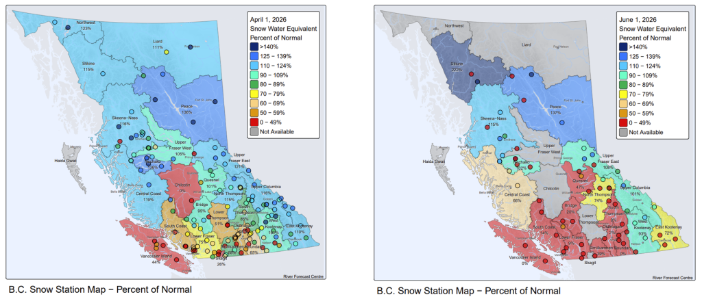
Spring 2026 conditions
Spring snowpack, measured at the beginning of April, varied drastically. Regions in the Southern Interior and Coast had well below their usual amounts of snow remaining, while northern regions and the eastern stretches of the province had normal or above-average spring snowpack.
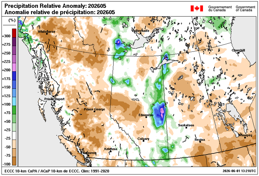
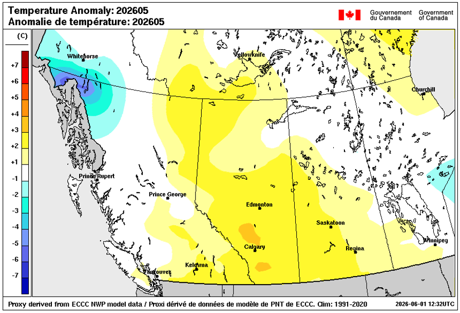
Most of the province experienced a warmer-than-average May, with only the Coast and Northwest experiencing average and cooler-than-usual temperatures. Importantly, there was well below-average precipitation across B.C. both in May and for the past 90 days.
Underlying drought conditions
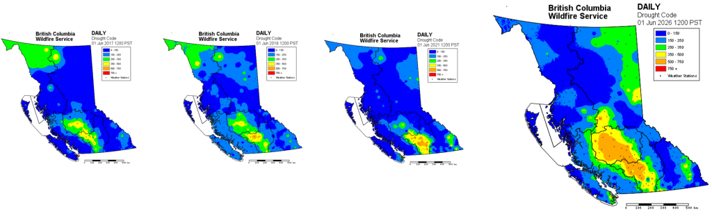
As a result of below-average precipitation and snowpack and above-average spring temperatures, the Drought Code, which measures the moisture levels in our deepest, heaviest forest fuels, is well above normal in some regions. This is most acute across a large swath stretching from Vanderhoof and Nadina, through the Chilcotin and down into the Fraser Canyon. Drought Codes are also above average in the Peace Region, parts of the Boundary, and on the southern tip of Vancouver Island.
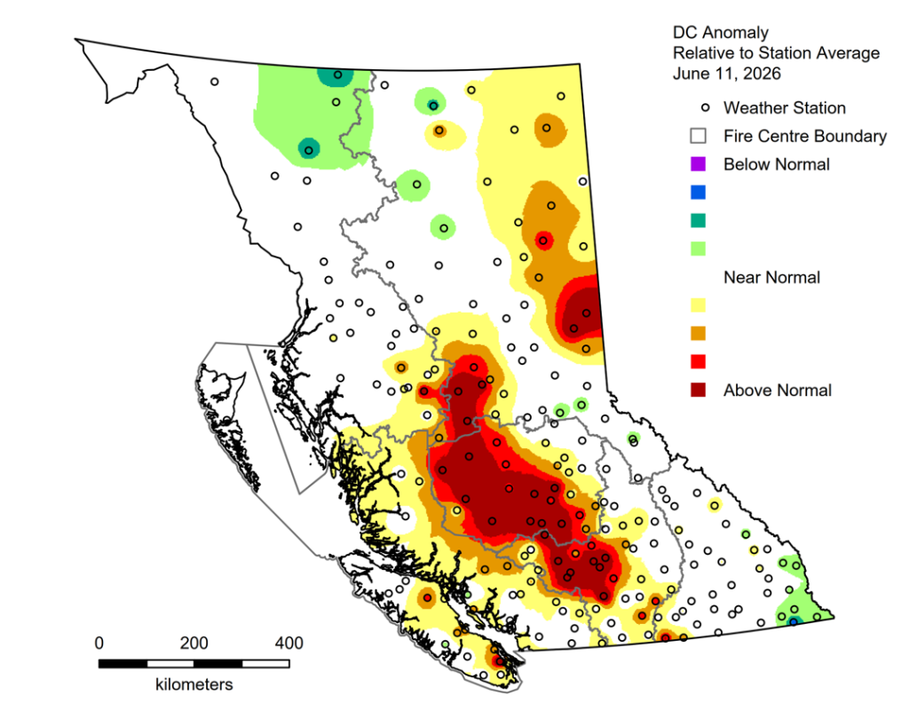
The current drought conditions are are similar to those experienced in years that saw heavy fire load in the Southern and Central Interior. See the below comparisons of Drought Codes in 2017, 2018, 2021 and this year:
Anticipated summer weather patterns
While predicting June rainfall is notoriously difficult, and long-rage weather outlooks are subject to change, experts anticipate warmer and drier-than-usual conditions this year. There is no current indication that B.C. will receive the rainfall needed to alleviate current drought conditions in June.
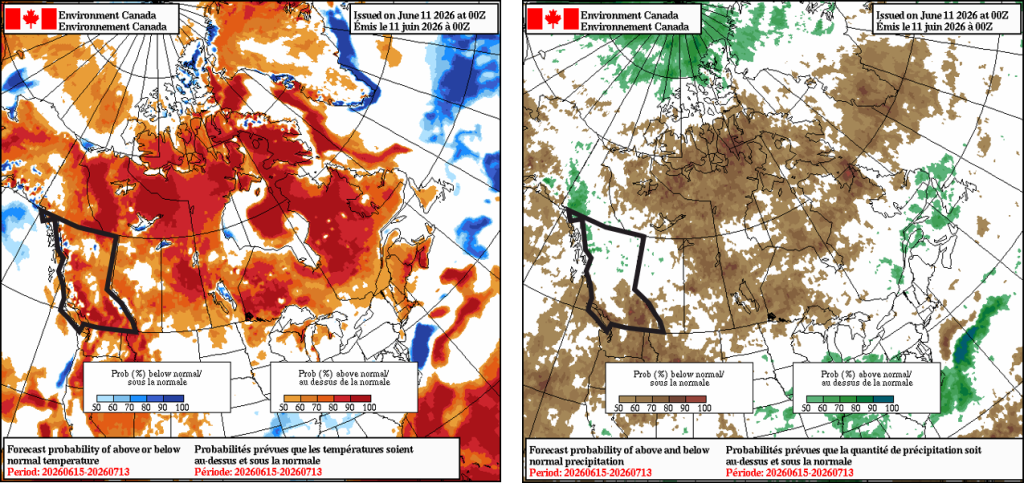
Current guidance shows the drought in the Chilcotin, South Thompson, Okanagan and Vancouver Island is likely to continue through the summer. As we approach mid-June, the amount of rain received in the coming weeks will be a crucial indicator of the core wildfire season ahead.
Summary
As we approach the historical core wildfire season, underlying drought and a warmer, drier spring are contributing to the potential for vigorous fire activity in some regions. Persistent drought and low snowpacks in the Southern Interior and Coastal regions has increased the risk of wildfire activity.
While current conditions indicate we are likely to see significant fire activity during July and August, the longer-term forecast depends on the amount of rain we receive in the weeks ahead.