TUMBLER RIDGE – The BC Wildfire Service has updated its Area Restriction Order for the vicinity of the Bearhole Lake wildfire (G72178). The size of the area restriction reflects the continued need to protect the public in areas where there are ongoing fire suppression activities.
This order takes effect at 12:00 noon on September 17, 2022 and remains in force until October 15, 2022 or until it is rescinded. The order applies to crown land within the geographic boundary described below and shown on the map provided:
Under this Order and Section 11(2) of the Wildfire Act, a person must not remain in or enter the restricted area without the prior written authorization of an official designated for the purposes of the Wildfire Act, unless the person enters the area only in the course of:
- Travelling to or from his or her residence;
- Using a highway as defined in the Highway Act;
- Travelling through or entering the area as a person acting in an official capacity; or
- Travelling through or entering the area for an approved purpose of supporting wildfire suppression activities.
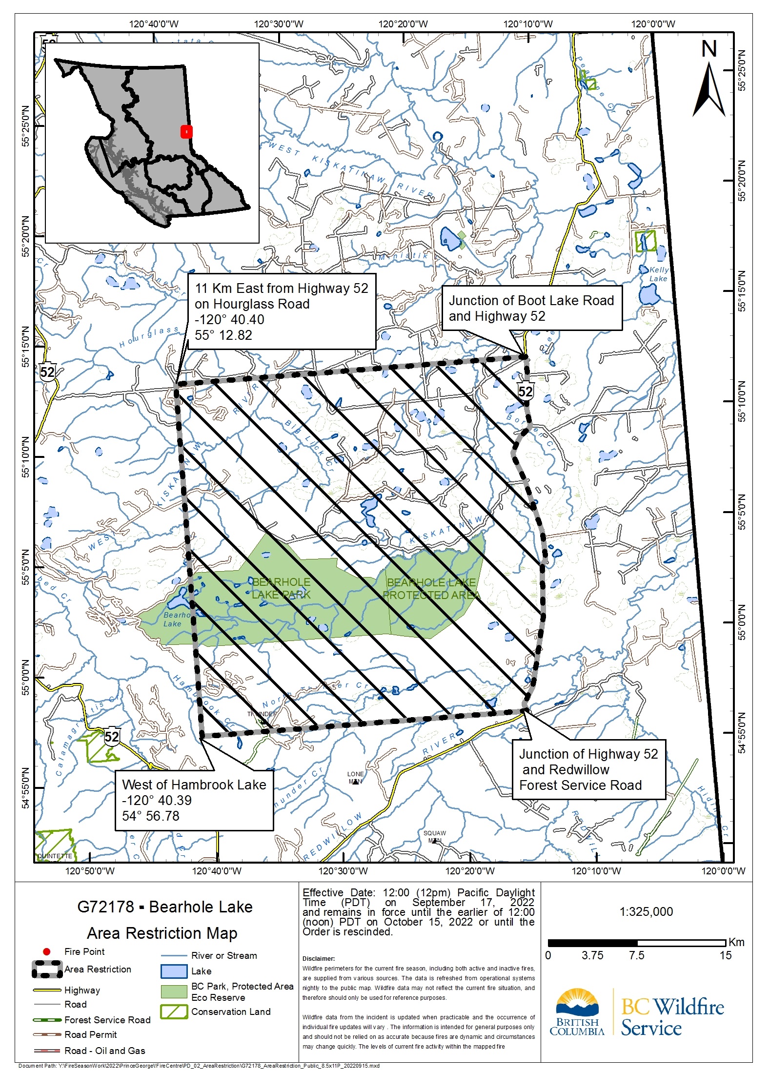
The order applies to crown land within the geographic boundary outlined below and shown on the map provided here
- Starting at the junction of Boot Lake Road and Highway 52; then heading South along Highway 52 for 31 km to the junction of Highway 52 and Redwillow Forest Service Road; then heading West for 27.5 km to a point west of Hambrook Lake; then heading North for 29.75 km to a point east of Highway 52, 11 km along Hourglass Road; then heading East for 30 km to the starting point at the junction of Boot Lake Road and Highway 52.
Failure to comply with Section 11 restricted area requirements may result in a violation ticket for $1,150.
Contact:
Bearhole Lake Fire Information Officer
BC Wildfire Service
Ministry of Forests
778 362-6020
BCWS.BearholeInformation@gov.bc.ca
Connect with the Province of B.C. at www.gov.bc.ca/connect