Spring summary
Since April 1, 2023, nearly 400 wildfires have burned more than 512,000 hectares in B.C. Ninety-nine per cent of this fire activity has occurred in the northeast regions of the Prince George Fire Centre. This area exceeds the total amount of hectares burned across the province in 16 of the last 20 fire seasons.
Throughout May, temperatures were consistently above seasonal averages, with daily temperatures ranging three to 10 degrees higher than normal. The amount of rain received was also considerably lower than historical norms, some areas receiving half of their average amount of precipitation.
Recent burning conditions
Under persistently dry conditions, wildfires will spread rapidly upon ignition when accompanied by strong winds, increasing the potential for wildfires to grow to a substantial size.
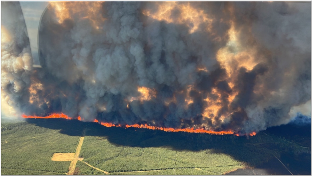
The lightning-caused Donnie Creek wildfire (G80280) was discovered on May 12, 136 km southeast of Fort Nelson. Between May 19 and 21, the fire received 40 mm of rain. In subsequent days, temperatures increased, and the wildfire saw significant growth in the span of five days. The Donnie Creek wildfire is the second largest wildfire ever recorded in B.C.
Summer wildfire outlook
Typically, the number and severity of wildfires in July and August depends on the amount of rain received in June. Current models predict the current drying and warming trend will continue through the first half of June. Despite a temporary cooling trend after this weekend, Environment Climate Change Canada (ECCC) is indicating a high probability of above-normal temperatures throughout the summer. It is unlikely the amount of rainfall forecast for the second half of June will be sufficient to alleviate the elevated drought conditions that have persisted since last fall. Until significant and prolonged precipitation is observed, fuels will continue to dry, resulting in deep burning and challenging firefighting conditions. The number of new wildfire starts will increase as we move through June and into July, the two months which typically see the most lightning activity. Overall, an early and more active start to the core wildfire season is anticipated.
Beyond June, the longer-range forecast suggests that temperatures will remain above seasonal through the remainder of the summer. Warmer-than-normal temperatures typically result in accelerated drying conditions and increase the risk of ignition from both lightning and humans in starting and sustaining wildland fires.
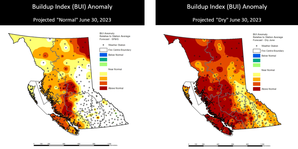
Fire behaviour indices
The build up index (BUI) is an estimate of the total amount of fuel available to ignite and burn on the landscape. It considers the moisture content within the middle and deeper organic layers, which directly affects fire intensity.
The BUI anomaly charts below represent two scenarios: on the left are forecast BUI anomalies should normal June rainfalls materialize, which currently seem unlikely. On the right is the dry scenario without significant rainfall by June 30. In both cases, elevated buildup indices are likely to persist heading into the core of the fire season.
Elevated BUI is consistent with fires that burn hotter and deeper, which can often challenge containment, especially during widespread or large-scale lightning events.