Hot, dry conditions coupled with winds have resulted in increased fire activity across the Southeast Fire Centre.
Thirty-one new fires have been detected since July 30, the majority of them suspected to be caused by lightning that moved through the region this past weekend.
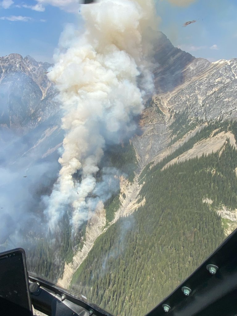
Existing fires are also exhibiting more intense fire behaviour resulting in smoke plumes and, in some cases, visible flames. Fire growth is expected on some fires currently classified as Out of Control.
No structures or communities are threatened at this time. The BC Wildfire Service is monitoring and responding to fires across the Southeast Fire Centre.
Further details on several fires of interest in the Southeast Fire Centre are as follows:
The North Lodgepole Creek wildfire (N12363) is burning 24 kilometres southeast of Fernie and 45 kilometres south of Sparwood. The fire, detected July 31, is suspected to be lightning-caused. Air tankers completed a retardant line around the fire on July 31 and Aug. 1. Ground crews with support from helicopters continue to work to suppress the fire, which is estimated at eight hectares.
The Birchlands Creek wildfire (N42228), which originated 17 kilometres southeast of Golden, B.C., is experiencing heightened fire activity due to weather conditions. The fire is currently burning in steep, inoperable terrain approximately five kilometres north of Highway 95 and eight kilometres south of the Trans-Canada Highway. Smoke is highly visible from surrounding communities and roadways. No communities or structures are presently threatened. The BC Wildfire Service is monitoring this fire and has plans to respond as required when and where it’s safe to do so.
The Kamma Creek wildfire (N71918), which originated 37 kilometres southwest of Cranbrook, is displaying increased fire behaviour as a result of hot, dry temperatures and winds. Smoke may be highly visible from Cranbrook, Kimberley, Wycliffe and other communities in the area. The fire size is estimated at 290 hectares. It is burning in a remote area and not threatening any structures or communities at this time. The BC Wildfire Service continues to monitor this fire and will respond as needed.
The Rugged Peak wildfire (N52396) was detected Tuesday afternoon approximately 16 kilometres southeast of Nakusp, B.C., and three kilometres south of Highway 6. Initial attack crews and aerial resources, including skimmers and helicopters, responded immediately. Firefighters continued to work on the fire throughout Wednesday. By afternoon, hot, dry conditions resulted in fire intensity increasing to a vigorous surface fire with torching or passive crown fire, forcing crews to pull back. Learn more about wildfire rank. Crews and aircraft continue to action the fire where possible Wednesday evening, when it was an estimated two hectares. Smoke may be visible from Nakusp, New Denver and surrounding communities, as well as to travellers on Highway 6.
The Jubilee Mountain wildfire (N22370) was detected on July 31 approximately five kilometres southwest of Harrogate and 10 kilometres northwest of Spillimacheen on the west side of the Columbia River. Initial attack crews supported by aircraft responded immediately with heavy equipment arriving later that afternoon. Since then, firefighters, heavy equipment and aircraft have continued suppression efforts. The fire is now estimated at 120 hectares.