PRINCE GEORGE – Effective at 6 p.m. on Sunday, September 24, 2023, the BC Wildfire Service is implementing an area restriction on the east flank of the Donnie Creek Complex due to increased wildfire activity.
This area restriction reflects the need to protect the public and BC Wildfire Service personnel in areas where fire suppression activities are taking place.
It will remain in force until the earlier of 12 p.m. (noon) PDT on Oct. 15, 2023, or until the Order is rescinded.
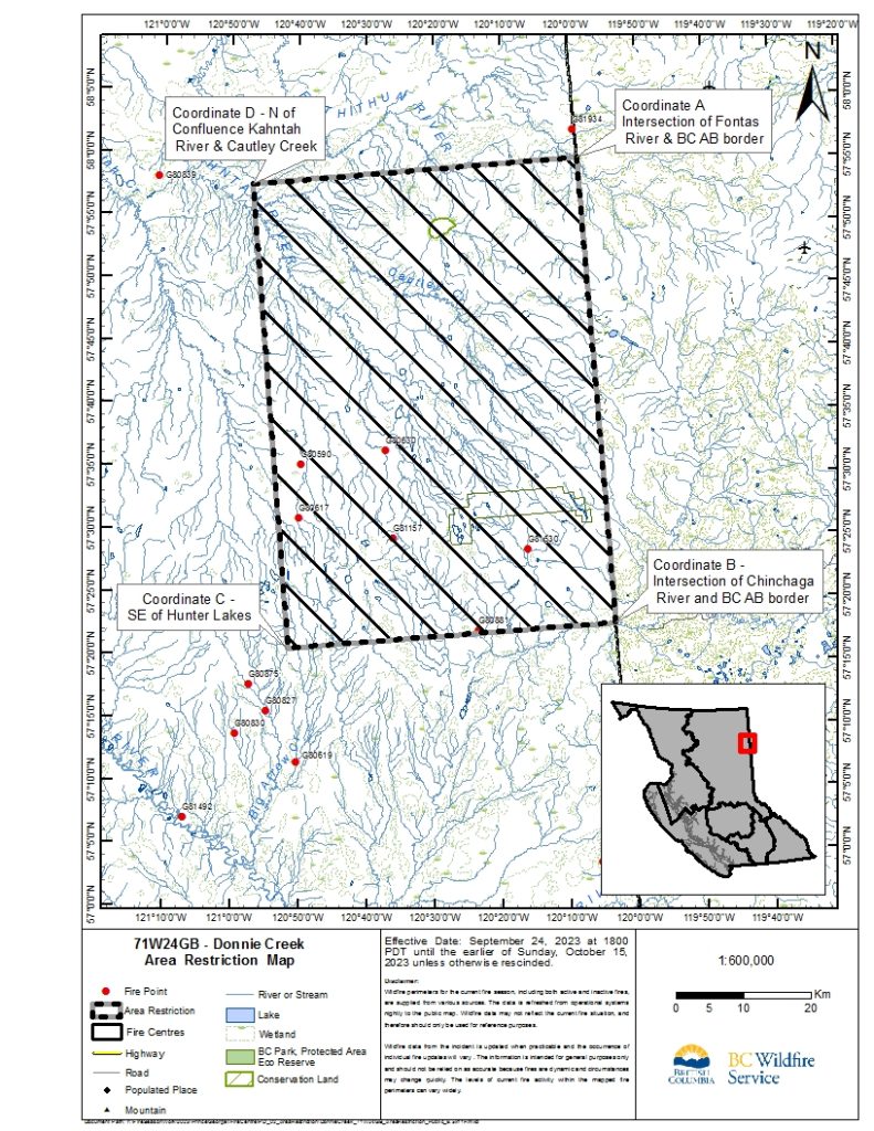
The restricted area runs from the intersection of Fontas River and the British Columbia-Alberta border at coordinate A (57º 56.548’N, -120º 00.000’W); South to the intersection of Chinchaga River and the British Columbia-Alberta border to coordinate B (57º 19.317’N, -120º 00.000’W); West to an area 13 km SE of Hunter Lakes at coordinate C (57º 19.317’N, -120º 48.738’W); North to an area 4 km N of the confluence of Kahntah Riner and Cautley Creek at coordinate D (57º 56.548’N, -120º 48.738W); and East to the starting point coordinate A.
Under this Order and section 11(2) of the Wildfire Act, a person must not remain in or enter the restricted area unless the person is:
- Travelling to or from his or her residence
- Using a highway as defined in the Transportation Act
- Entering the area for the purposes of carrying out an industrial activity as defined in the Wildfire Act
- Entering the area as a person acting in an official capacity; or
- Entering the area for an approved purpose of supporting wildfire suppression activities
A full map of the restriction can be seen below:

Follow the latest wildfire news:
- on the free BC Wildfire Service public mobile app, available for Apple (iOS) and Android devices
- on Twitter
- on Facebook
Contact:
Prince George Fire Centre Information Team
BC Wildfire Service | Ministry of Forests
250-561-4629
INFOPG@gov.bc.ca Connect with the Province of B.C. at www.gov.bc.ca/connect
